North Carolina
Today is (Thurs.) May 1, 2025. New month, new state – we cross into North Carolina today. Before that, however, we took the dogs back to the beach near our anchorage at Bird Island for one last walk.


The first sight we had after leaving the anchorage was of some guys pulling their very own floating tiki bar – just in time for their weekend, I guess.

Along the way, we saw more of the tall, several-story homes like we’d seen in SC, some along the ocean shore and some tucked in canals (that appear to be manmade) off the AICW.


There were some beautiful views, especially near inlets (from the ocean).

We also saw more incomprehensively long piers. Many lined the east side of the AICW, eventually connecting to a house on shore. What you can’t see in the one pictured below is the section that continues to run along the shore for an additional length equaling half of the length you do see.

Another interesting feature of the area was the presence of ocean viewing spots that people would create for their properties such as the one pictured in the following photo.

Reaching an area where other Loopers we know (“Unbridled”) got pushed off course and damaged a prop, we saw a dredging operation with the auger tipped up and in view.

We made it to Southport around noon, so I had time to throw in a load of wash. At the laundry, I ran into Cathy (“Remedy”) and shared with her that we’d been contacted on Nebo by Robert Creech, a man famous in Looper circles. Robert and his wife Kay – having successfully completed the Loop years ago and being regular presenters at AGLCA Rendezvous – hold informal briefings on their porch for Loopers in Southport and have been doing so for many, many years. Any Looper visiting Southport is invited to the Creech’s porch (below). Cathy knew that her husband Lee would want to attend also. Later, Robert stopped by our boat to make sure we’d gotten the invitation.

We had an opportunity to talk a bit with Robert while we waited on others to arrive.

Soon we were joined on the porch by Robert’s wife, Kay, Greg and Angie (“Summer Breeze”), Lee and Cathy (“Remedy”), and a couple from Maine that weren’t on the Loop but were just interested in the knowledge supplied by Robert.

Chuck and Kim (“Til You Can’t”) and Todd and Betsy (“Cat in the Hatt”) stopped by later, so the porch really filled up at that point!
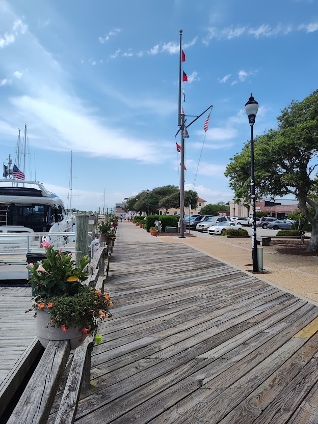
Southport is a lovely little coastal town. We had the opportunity to explore it on bikes with Chuck and Kim the next day, Fri., May 2. The waterfront is lined with cottages, and most of the homes have plaques indicating the original owners and their role in the community at that time.
As in SC, NC has jasmine growing and flourishing along its many fences and arbors. The smell is absolutely amazing! We also saw and learned about Crepe Myrtle trees with their smooth bark. Though the photo of the tree below was taken in SC, we saw many Crepe Myrtles in NC, as well.


Stopping by the town’s maritime museum, we stepped up our speed, as they were closing in 10 minutes. With such rich history at every stop, it’s hard to fit it all in!
On our rapid tour of the museum, I did learn some quick facts about the shrimping industry in NC which first started in the Cape Fear area, with a demand for shrimp beginning after the Civil War. Southport got its first shrimp cannery in 1915. The success of the Southport shrimp industry was such that at one time over 200 shrimp boats clogged the waterfront. Business thrived until the 1950s when an increase in imports, costs, and regulations plus fewer harvests slowed growth. Though diminished from its previous boom, the industry remains vital, landing just under five million pounds of shrimp annually!
Our last few minutes of the 10-minute tour included a view through the periscope originally on the USS Dolphin.

We left very early the next morning (Sat., May 3) with “Til You Can’t” and “2nd Chance.” Barb and Doug off the latter boat had come in yesterday to Southport. Their boat is pictured closest to shore in the row nearest us in the first following sunrise photo. Lights are on; they’re ready to go!


It’s going to be a long day to reach our destination, the Mile Hammock anchorage.
Today’s first interesting sight was parachutists followed by a flashing white night light, an aid to the many ocean-going vessels involved in what appears to be the active commercial shipping industry here.


We are on the Cape Fear River, and there are many ferries plus a number of areas of restricted or regulated water (i.e., areas we are to avoid entering). One such area is the security barrier for the Military Ocean Terminal at Sunny Point (MOTSU), one of the largest military terminals in the world. It is essentially in the middle of nowhere but highly guarded/protected by what appeared to be two tall guard towers by the ship and dock, multiple bright red warning signs, and a patrol boat policing the perimeter. Installation-related radar domes are on the opposite shore.

At Wrightsville Beach City we happened upon a puzzling sight; if you look at the boat pictured below, it is difficult to imagine how it was pinched into the slip that surrounds it! Our boat doesn’t have bow thrusters, but that maneuver would still be challenging with the assistance of thrusters.

The water here is a beautiful aquamarine. We still see marshy lowlands, but there have been more trees visible. Also, we often see sandy beaches and dunes as well as more large homes along the shoreline.


At one point, a paddleboarder was intentionally paddling between our three boats trying to surf our wakes! While we’ve had jet skiers do that, we’ve never had a paddleboarder try to paddle fast enough between boats. Not the safest thing we’ve seen so far! This stunt was followed by a 50-foot boat that passed us while we were both traveling under a bridge! Never a dull moment.
Meanwhile, our friend, Mike, from FL had texted Dennis that today was Derby Day, and his wife Betsy said she had her Derby Day hat picked out. So, I donned a boat version. I don’t think that’s quite the look people at the Derby are going for, however!

We reached the Mile Hammock anchorage around 3:00 – eight hour day. The water here is back to the more brownish hue. This anchorage borders Camp Lejeune. There was a large boat ramp with numerous boats and people who were clearly using the area recreationally. We were fairly certain that this locale was reserved for military use only, yet we didn’t see any signage indicating that. But, these boaters were likely military or family of those in the military.
We approached the ramp just to see if it might be OK to take the dogs to shore and talked with a guy there who said it would all be fine unless, of course, the MPs showed up! When we got nearer to shore, there was a sign pointing the other way. While Dennis stayed with the boat, the dogs and I got out and headed over to read the sign only to learn that those without proper military ID would be considered trespassers and would be fined thousands of dollars if found on shore! We quickly loaded the dogs back on and found a beach that while quite a ways away worked for us a couple more times that day.
Plans for the next morning, Sun., May 4, were to leave at 7:15 in order to make the 8:00 nearby bridge opening. Unfortunately, there was a very nasty storm impending that morning, so we made the decision to “trespass” and took the dogs to the close by military boat ramp. Another rule-breaking boater was bringing his dog there at the same time. The rain began in earnest, and we were headed back when signaled by the other boater for help because the motor on his inflatable wouldn’t start. We ended up towing him back to his sailboat (“Peakabu”). By the time we got our inflatable back and loaded, we were all soaked. However, we were back inside the boat before the high winds (35 mph gusts) and lightning started. After the worst of the storm had passed and we got underway, Nelson didn’t kick off the towel Dennis wrapped him in, so we knew he was cold.

After crossing under the Onslow Bridge, we entered another area with restrictions, still part of Camp Lejeune. In addition to the guard tower, multiple bright red signs said, “Danger: Unexploded Ordinance. Do Not Enter.”


Even better, other signs read: “Stop Do Not Proceed. Live Firing In Progress When Flashing.” Fortunately, it was not flashing.
On a lighter note, the prominent, “dueling” staircases on these three homes right in a row that we saw soon after leaving the restricted area caught my eye.

By 2:30, we reached Town Creek Marina in Beaufort with enough time remaining in the day to take the courtesy car for provisions. First time ever at a Piggly Wiggly. The second night in Beaufort, we were able to have an excellent dinner and great conversation with Barbara and Doug (“2nd Chance”) and Kim and Chuck (“Til You Can’t) at Ribeye’s downtown. Included below are a few views of the charming coastal town.


The “Old Burying Ground” in Beaufort is on the National Register of Historic Places. As explained by the literature available there, the “earliest graves are marked with shell, brick, or wooden slabs, because stone markers had to be brought from afar by wooden sailing vessels.”


Similar to other graves we’ve viewed when touring southern estates, we again saw “vaulted graves bricked over [or covered] in an attempt to protect them from high water and wild animals.” Some plots here had Confederate States of America grave markers.


When we left on Tues., May 6, the wind had lessened from previous days which was fortunate, as we had to traverse the very wide Neuse River. Doug (“2nd Chance”) said that when they had crossed it last, there were four to five foot waves. From the Neuse
River we joined the Bay River then a narrow portion of the AICW. There were marshlands on either side but some trees, as well. In the first picture below, you can see the marshlands in the distance behind Dennis at the helm steering with his knee through this calm water! We passed a shrimping fleet that accesses the ocean through Jones Bay.


Our group of three boats anchored in Campbell’s Creek for the night.


We were thrilled with a “beach” (first picture below) to take the dogs to shore!


It was a beautiful anchorage, and we enjoyed an inflatable ride and a lovely evening.


Off the back of the swim platform, we spotted some jellyfish close to the boat.


The next morning, Wed., May 7, when running the generator, we noticed that it started making a strange sound. When Dennis looked over the side and saw that no water was being pumped out, he immediately shut off the generator. After some investigation, he found tentacles in the sea strainer. One or more of those ethereal jellyfish had gotten sucked into the system! Now, how to get the jellyfish parts out when you can’t use a vacuum – because you don’t have electricity – because you can’t use the generator??!
Meanwhile, breakfast breads had to be toasted the old fashioned way.

And, eventually, jellyfish parts were extracted the old fashioned way, also, using a long-necked brush. Fortunately, the rest of the jellyfish that must’ve been too large to get sucked in the system but was blocking the intake must’ve been swept away by current as we travelled, as we were able to use the generator later while underway. Very important!
Passed Durant’s Point. No relation.

Listening to weather reports through this area is kind of fun, because they talk about weather in Duck and Kitty Hawk, places where we vacationed for years as a family.
We took the Pamlico River to the Pungo River then the Alligator River which connects with the Pungo River Canal. The canal is a Cypress Swamp. The water here is a striking brown color.

Here is the Captain and a crew member on break.

Though we were going to anchor around Mile Marker 101 at Grapevine, we all decided to continue to Mile Marker 82 and go into South Lake, an anchorage used by Doug and Barbara previously. It would also serve to put us closer to Albemarle Sound in the morning for crossing. Had to pass through a swing bridge before making the turn toward the anchorage. The bridge was an extremely long one, and traffic had to come to a stop for quite some way. The first two pictures below show the left side of the bridge as we approached, the third shows “Til You Can’t” and “2nd Chance” passing through the bridge opening, and the fourth shows part of the lengthy stretch of bridge to the right.


To get in and out of the anchorage, we had to pass Durant’s Island. Maybe we have some long lost relatives down here after all.

The anchorage was a ways in but was protected. Finding the reported boat ramp for the dogs that evening was difficult. It was starting to get dark, and we were surrounded by marshlands …

… so locating this boat ramp would be our only option for taking the dogs to shore. After a good bit of searching, we found this narrow passageway (below; picture taken in morning, so it’s lighter) that led to the very small, gravel boat ramp. Everyone in the inflatable was very happy to see it!

On Thurs., May 8, we crossed Albemarle Sound early, as suggested, in order to avoid the stronger winds that tend to build in the afternoon. Dodging crab pots was the order of the day, both coming out of the anchorage and in the Sound. At one point when I was driving, I had to dodge a crab boat that decided to fly right in front of us. Not sure if Den snapped this picture before or after the crab boat excitement.

Leaving the Sound and joining the North River, we kept hearing people talking at some length on Channel 16 (the international distress frequency) in an Asian language. Eventually, they switched to Channel 71, a working channel that we use between our three boats. So, we continued to hear multiple conversations. The only other boats visible or showing up on AIS were crab boats. We later passed a crab boat, and one of the workers on the boat was wearing a coolie hat, a conically-shaped straw sun hat. Evidently, we’d been hearing a group of crab boat workers talking between boats.
We reached Coinjock Marina, famous for the prime rib dinners at its marina restaurant. Four members of our dinner party had to take advantage of that entree item. While in the restaurant it was good to see Mary and Jim (“Legacy”) whom we’d met in Canada but had been talking with on and off recently since Wacca Wache, as they are veteran Loopers and very informative. A couple diners had some of that (also famous, perhaps) NC shrimp. I can’t help but include another picture of one of the shrimpers we saw on the way (even though I think we saw it in northern SC). Tomorrow we will be leaving NC and entering VA and the southern part of the Chesapeake Bay area.


